Spatial Planning Trends Transforming Formerly Rural Zones into Urban Residential Hubs
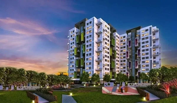
Featured Image of Spatial Planning Trends Transforming Formerly Rural Zones into Urban Residential Hubs


Spatial Planning Trends Transforming Formerly Rural Zones into Urban Residential Hubs include the 200-acre Embassy Knowledge Park township, the expansion of NH-44, the upcoming Namma Metro Phase 3, and the rapid growth of Aerospace Park.

These developments are converting Tharahunise and nearby villages into planned residential neighbourhoods. New schools, hospitals, retail centres, and employment hubs are supporting this transition. Together, these infrastructure and real estate projects are reshaping North Bangalore into a well-connected urban growth corridor.

Global cities are going through a major shift in how they plan space. Formerly rural areas are turning into well-connected urban hubs. Places like Embassy Knowledge Park show this change clearly. In the past, city planners kept farmland separate from busy city centers. Now, this old approach is changing fast.

Cities have a problem in their downtown areas. To solve this, planners are now using smart ways to plan cities. These ways change the land on the outskirts of cities into areas with a mix of things to do. These areas have offices and homes next to each other.

The cities don't get too crowded, yet they are still very useful. Good public transportation connects everything, making it easy to get around. This helps prevent traffic jams from getting worse over time. It also helps the value of homes and buildings go up every year.
1. Big Transit Networks Changing the Northern IT Belt


What public transport options exist in the North Zone?

The main transit system includes BMTC buses, the Namma Metro Blue Line, and the Bengaluru Suburban Railway Project (BSRP). BMTC runs special low-floor AC buses called Vayu Vajra. These buses connect northern areas straight to major office hubs.

At the same time, BMRCL is building elevated tracks for the 39-kilometer Blue Line. This line will have seventeen stations leading straight to the airport. K-RIDE is also building the BSRP rail system. These new tracks will run alongside existing train lines.

Why are corporate commuters choosing public transit in the suburbs?

Tech growth in the suburbs has increased the distance between homes and offices. Driving through traffic raises fuel costs. It also causes delays that are hard to predict. Public transit avoids these problems. It runs on fixed tracks and dedicated lanes.

Companies say that easy access to public transit reduces employee tiredness. It also helps them keep good staff longer. Public transit tickets also cost less per kilometer. This helps workers save money each month.

How are different transport modes being connected?

City planners are building "Smart Station Hubs." These let people switch easily between transport types. The upcoming Yelahanka Metro Station will have a skywalk. This walkway connects directly to the Yelahanka Junction railway station.

BMTC also runs feeder buses right below these elevated stations. Because of this setup, commuters can switch between train, metro, and bus routes easily. They can do this all using one smart card.

Where is most transport development happening?

A lot of transportation growth is happening on Bellary Road. This is also known as NH-44. The IVC Road loop near Bellary Road is also getting a lot of work done.

Places like Tharahunise, Chikkajala, and Bagalur Cross are really important for transportation. These areas connect neighborhoods in the north to new industrial parks.

2. Focus: Transit Access Near Embassy Knowledge Park


Embassy Knowledge Park plays a key role in this transit shift. It makes up about twenty percent of this transformation story. The Embassy Group built this large, 200-acre township. It sits on Chapparkallu Road in Tharahunise, Yelahanka. Instead of using only internal transport, residents rely on nearby transit hubs.

  • Tharahunise Bus Stop - This stop is 1.2 Km from the site. You need to exit the gate and go south on Chapparkallu Road. After that, you turn onto Tharahunise Main Road. It takes three to four minutes to get by shuttle or auto.

You can also. Use a bike-sharing service, and there is a wide path for that. This stop is connected directly to highway loops and local markets.

  • Doddajala Namma Metro Station (Phase 2B Line) - This station is 7.0 kilometers away. Head west on Chapparkallu Road, cross IVC Road, then join NH-44 heading north.

The trip takes 12 to 15 minutes during normal hours. E-mobility feeders or auto pools from Tharahunise junction also work. This station links directly to Kempegowda International Airport.

  • Bettahalsoor Railway Station - To get to Bettahalsoor Railway Station, you need to go 6.2 kilometers from the site. You have to travel on Chapparkallu Road. Then you will pass through some villages.

After that, you need to join Bettahalsoor Main Road to get to the station. It takes around 10 to 12 minutes by car to get there. There are also cabs and private mini-buses that run on regular schedules.

  • Yelahanka Junction Railway Hub - If you want to go to Yelahanka Junction Railway Hub, it is 8.0 kilometers away. You have to head on Chapparkallu Road. Then you need to join NH-44 south. You will pass the Kogilu Cross flyover.

After that, you need to exit onto Yelahanka Main Road to get to the hub. The trip takes around 18 to 22 minutes, depending on the traffic.

3. Transit Costs and Timelines


Fast transit networks now offer clear pricing and schedules across the northern zone.

What do public transit options cost, and when do they run?

This table shows prices, hours, and routes for regional travel:

Public Transit Option Average Ticket Price Standard Operating Hours Primary Route Corridor Alternative Transit Choice Proximity to Major Tech Areas
BMTC Vayu Vajra AC ₹150 – ₹250 / Trip 24 Hours Operational NH-44 Expressway to KIA Terminals Standard Non-AC City Bus Direct access to Hebbal and Manyata Hubs
Namma Metro Blue Line ₹20 – ₹60 / Trip 05:00 AM – 11:30 PM Central Silk Board to Airport Axis Auto Rickshaw Feeder Systems 7.6 km from Prestige Tech Cloud Park
BSRP Suburban Rail ₹15 – ₹35 / Trip 06:00 AM – 10:00 PM Corridor 1: KSR Bengaluru to Devanahalli Indian Railways Passenger Trains 8.0 km from Yelahanka Junction Hub
App-Based Ride Pools ₹180 – ₹300 / Trip 24 Hours Operational Citywide Service Across Bengaluru BMTC & Metro Connectivity Direct connectivity to major IT parks across North Bengaluru

Flexible Local Suburb Connectors Fixed-Route Corporate Cabs Serves immediate Tharahunise tech blocks


What is the timeline for new transit growth?

New transit systems will boost property values nearby over time, step by step:

Milestone Date Details
Metro Line 2B Technical Trials October 2026 Bangalore Metro Rail Corporation Limited begins the first test runs along the airport corridor.
BSRP Priority Lines Opening March 2027 K-RIDE completes the first priority routes, including Corridor 4 extensions.
Airport Elevated Metro Launch June 2027 The 39-km Blue Line opens with 17 elevated stations connecting the airport corridor.
Regional STRR Final Integration December 2030 The Satellite Town Ring Road fully connects with the northern entry toll plazas.

FAQs


1. Why do tech companies prefer integrated townships over standalone office buildings?

Townships bring together good office spaces, homes, and shops in one place. This planned layout cuts down travel time. It helps protect employee performance every day.

2. Where is Embassy Knowledge Park located, and how is it connected to transit?

This 200-acre township sits on Chapparkallu Road, off IVC Road, in Tharahunise, Yelahanka. The site is 15 kilometers from the airport. It is 7.6 kilometers from Prestige Tech Cloud Park.

3. What other transport options do daily commuters have nearby?

Workers use electric bike-sharing apps, and auto-rickshaw stands at Tharahunise Junction. Corporate shuttles also run straight to the Yelahanka train station.

Enquiry
Enquire Now