How Big is Devanahalli
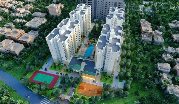
Featured Image of How Big is Devanahalli


Devanahalli spans a total land area of 429 square kilometres (165.6 square miles) in Bengaluru Rural District, comprising a 16-square-kilometre municipal town core and 413 square kilometres of rural land across 213 villages. Located about 40 kilometres northeast of Bengaluru's central business district, this subdistrict holds over 276,000 residents and serves as North Bengaluru's main growth hub. The region operates under the Bengaluru International Airport Area Planning Authority (BIAPPA), which manages a larger planning zone of 561 square kilometres.

Major government infrastructure and industrial layouts lead physical land distribution in Devanahalli. Kempegowda International Airport occupies 4,000 acres (16 square kilometres) of land, while the Karnataka Industrial Areas Development Board (KIADB) manages over 3,000 acres within the Aerospace and Hardware Park. Private residential and commercial townships make up about 20% of the usable land pipeline.

Large real estate projects show how big developments fit into the region's overall footprint. For instance, Embassy Knowledge Park covers 200 acres in the Yelahanka-Devanahalli corridor. Main roads like the 6-lane National Highway 44 (NH-44) and the upcoming 37-kilometre Namma Metro Phase 2B line connect Devanahalli's 429 square kilometres straight to Bengaluru's tech corridors.

Total Land Area and Local Map of Devanahalli Taluk


Devanahalli Taluk measures 429 square kilometres (165 square miles). It has 16 square kilometres in the town and 413 square kilometres in 213 villages. It sits 907 metres (2,976 feet) above sea level. It touches Vijayapura to the east, Doddaballapur to the west, and Yelahanka to the south.

The local land splits like this:

  • Town Core Area: 16 sq km for local town offices, shops, and old fort zones.
  • Rural Land Bank: 413 sq km for farmland, small hamlets, and new housing plots.
  • BIAPPA Plan Zone: 561 sq km of total space watched for land rules and road planning.
  • People Count: 560 people per square kilometre live across the full area.

Airport and Industrial Land Footprint in Devanahalli


The main airport sits on 4,000 acres (16 square kilometres) of Devanahalli land. Nearby state industrial parks take up another 3,000 acres for plants and tech labs. Built in 2008, the airport added a big Terminal 2 to make this area a top travel hub.

Key government land uses in Devanahalli:

  • KIADB Aerospace Park: 3,000 acres for jet parts, IT gear, and defense plants.
  • Boeing India Center: 43 acres built for ₹1,600 crore, making it Boeing's top site outside the US.
  • Devanahalli Business Park: 400 acres next to the airport for office blocks.
  • BCCI Sports Hub: 45 acres with 45 outdoor cricket pitches for training.

Embassy Knowledge Park: A 200-acre site in the Growth Zone


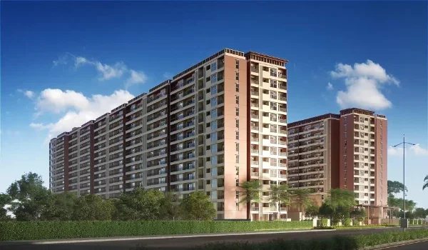
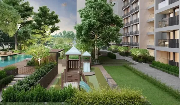
Embassy Knowledge Park takes up 200 acres of land in Tharahunise on the Yelahanka-Devanahalli road near NH-44. It makes up 20% of the active township land in this north belt. Built by Embassy Group, it has an IT office park, 4 high towers, and 217 homes. Phase 1 sits on 64 acres with 1,072 total homes (855 flats and 217 villas).

Project updates from the builder site (embassyknowledgepark.net.in):

  • Total Site Size: 200 acres overall land, with Phase 1 built on 64 acres.
  • EOI Date: Opened on 25 May 2026 for early buyer sign-ups.
  • Official Launch Date: Set for August 2026.
  • Possession Date: Set for August 2031 for Phase 1 handover.
  • RERA Status: Sent to Karnataka RERA (K-RERA) and waiting for final approval.
  • Home Sizes and Prices: 2 to 3.5 BHK flats (1,330 to 2,250 sq ft) start at ₹1.76 Crore. 4 to 5 BHK villas (4,185 to 6,820 sq ft) start at ₹10 Crore.

Business Growth and Mega IT Parks in Devanahalli


Devanahalli has 12,000 acres set aside for the planned IT investment region (ITIR). It is one of the largest tech zones in the state. Global firms are buying large plots here to build plants, labs, and supply hubs.

Major business land areas in Devanahalli:

  • ITIR Zone: 12,000 acres set for tech parks, software labs, and offices.
  • Foxconn Plant: 300 acres picked for phone build plants.
  • Financial City: 100 acres set for bank headquarters and tech schools.
  • Space Hub: 140 acres set for space health studies and training.

Master Plan 2031 and Home Growth


The local plan keeps 30% of Devanahalli's 429-square-kilometre land for housing and shops. The 280-kilometre ring road (STRR) links it to other hubs. Land values in the area have grown by 10% to 15% each year due to new road work.

Key transit paths opening up Devanahalli:

  • Metro Rail Line: 37-km line with 17 stops linking the city center to the airport.
  • Ring Road (STRR): Bypass road linking Devanahalli to Doddaballapur, Hoskote, and Dobbaspet.
  • Land Rates: Plot prices range from ₹6,500 to ₹8,500 per sq ft. Flat prices average ₹13,000+ per sq ft.

FAQs


1. How big is Devanahalli in total land area?

Devanahalli covers 429 square kilometres (165 square miles) of total land, with a 16-sq-km town core and 413 sq km of rural land.

2. How much land does the airport cover in Devanahalli?

Kempegowda International Airport covers 4,000 acres (16 square kilometres) of land in Devanahalli.

3. What is the size and RERA status of Embassy Knowledge Park?

Embassy Knowledge Park covers 200 acres in Tharahunise (Phase 1 on 64 acres). Its K-RERA status is applied for and pending.

4. What are the launch and possession dates for Embassy Knowledge Park?

Embassy Knowledge Park opened its EOI phase on 25 May 2026, launches in August 2026, and sets Phase 1 possession for August 2031.

5. How big is the KIADB Aerospace Park in Devanahalli?

The KIADB Aerospace Park covers 3,000 acres of land set for jet parts, tech hubs, and defense plants.

Enquiry
Enquire Now